

Subsea and subsurface workspaces for offshore wind projects
See how developers and contractors connect survey data, ground models and cable designs in one secure, visual workspace - collaborating to improve visibility, communication and move efficiently from design to operations.
One view, shared understanding
- Survey and ground data often live in disconnected systems, from GIS and borehole databases to ROV video and as-built reports.
- Developers and contractors each manage their own datasets.
- But without a shared view, teams spend too much time reconciling data, duplicating analysis. often missing valuable data and insights stranded in specialist applications or servers
- The result is overengineering in design and inefficiency in maintenance, with insights lost across phases.
One platform, unified decisions
-
FieldTwin connects developers, EPCIs and engineering partners in a single geospatial workspace where survey, subsurface and design data come together.
- All stakeholders work securely from the same model, in the cloud – visualizing, comparing and managing updates as conditions change.
- FieldTwin makes sure the full array of available data is accessible to optimise designs, manage risk and streamline operations.
An integrated view of seabed and subsurface data
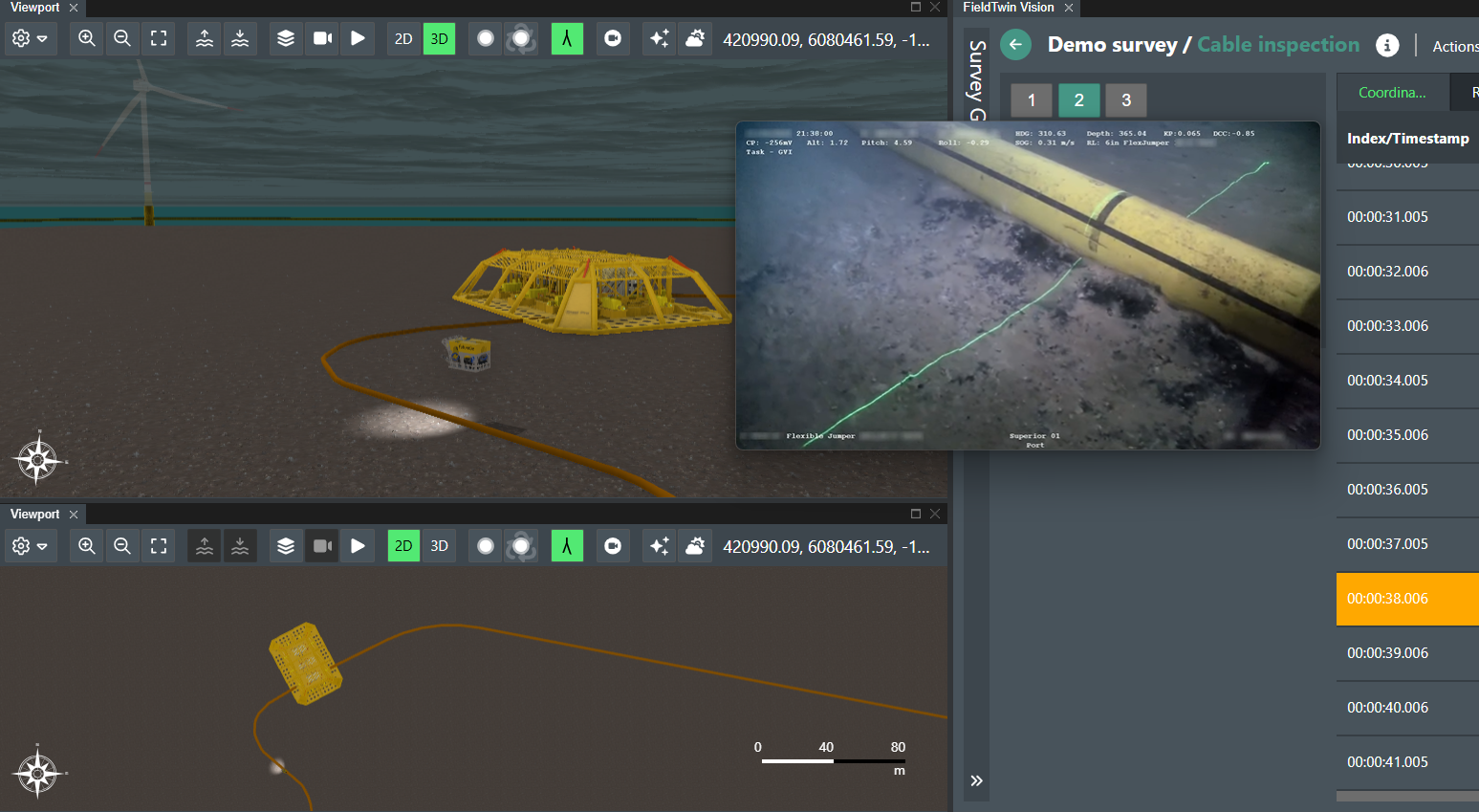
A developer and its T&I contractor prepare for interarray cable lay and seabed engineering while new survey data lands: interpreted ground models, boreholes and ROV clips arrive from different contractors.
In FieldTwin, the team opens a single 3D workspace to see the latest layers, compare microrouting, trenching and burial scenarios, trace cable options, and capture decisions that will carry into construction and O&M. Here’s how.
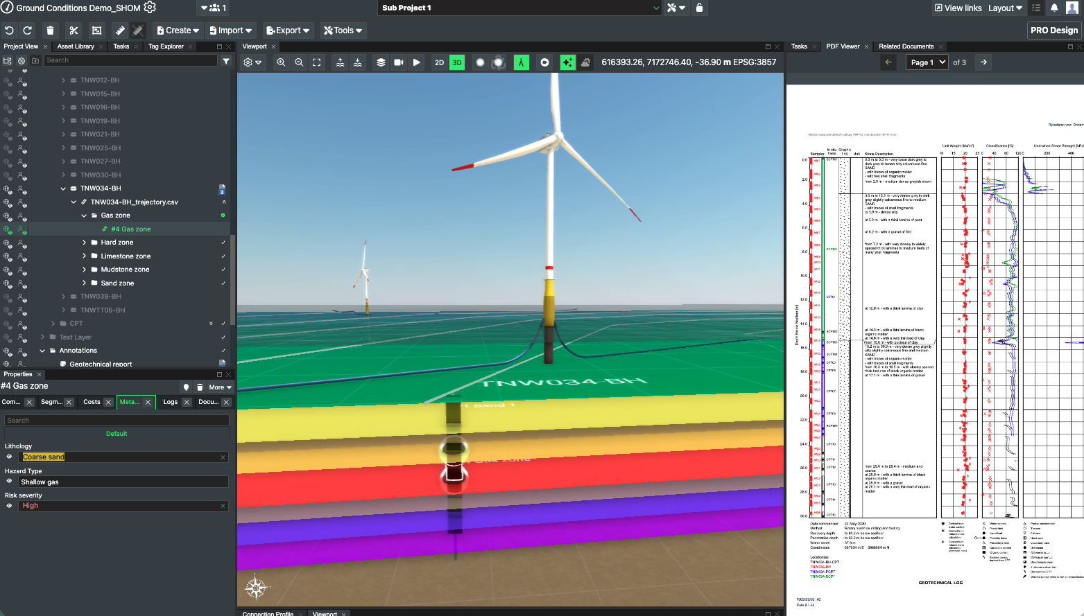
Connect survey and ground models
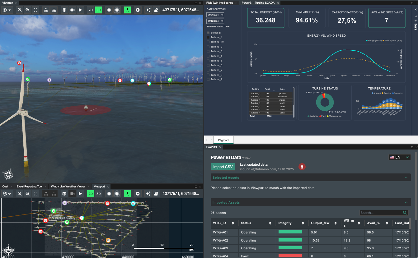
- Borehole data, ROV footage, survey models, and GIS layers are all accessed in a single visual workspace.
- Spatial and temporal data becomes aligned, so every decision reflects the latest seabed conditions and changes against historical conditions are recorded.
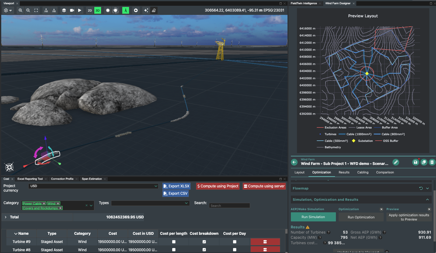
- Design updates are modelled in Wind Farm Designer to compare and iterate.
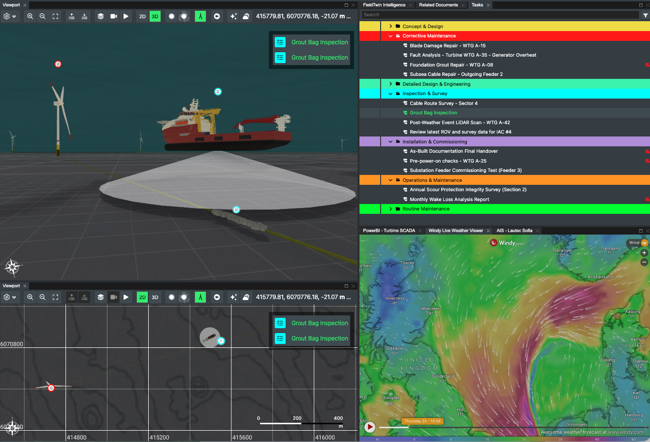
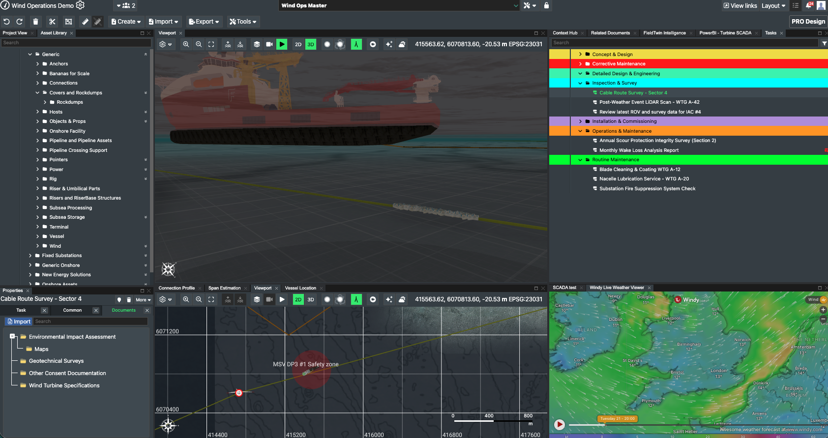
Collaborate across disciplines and contractors
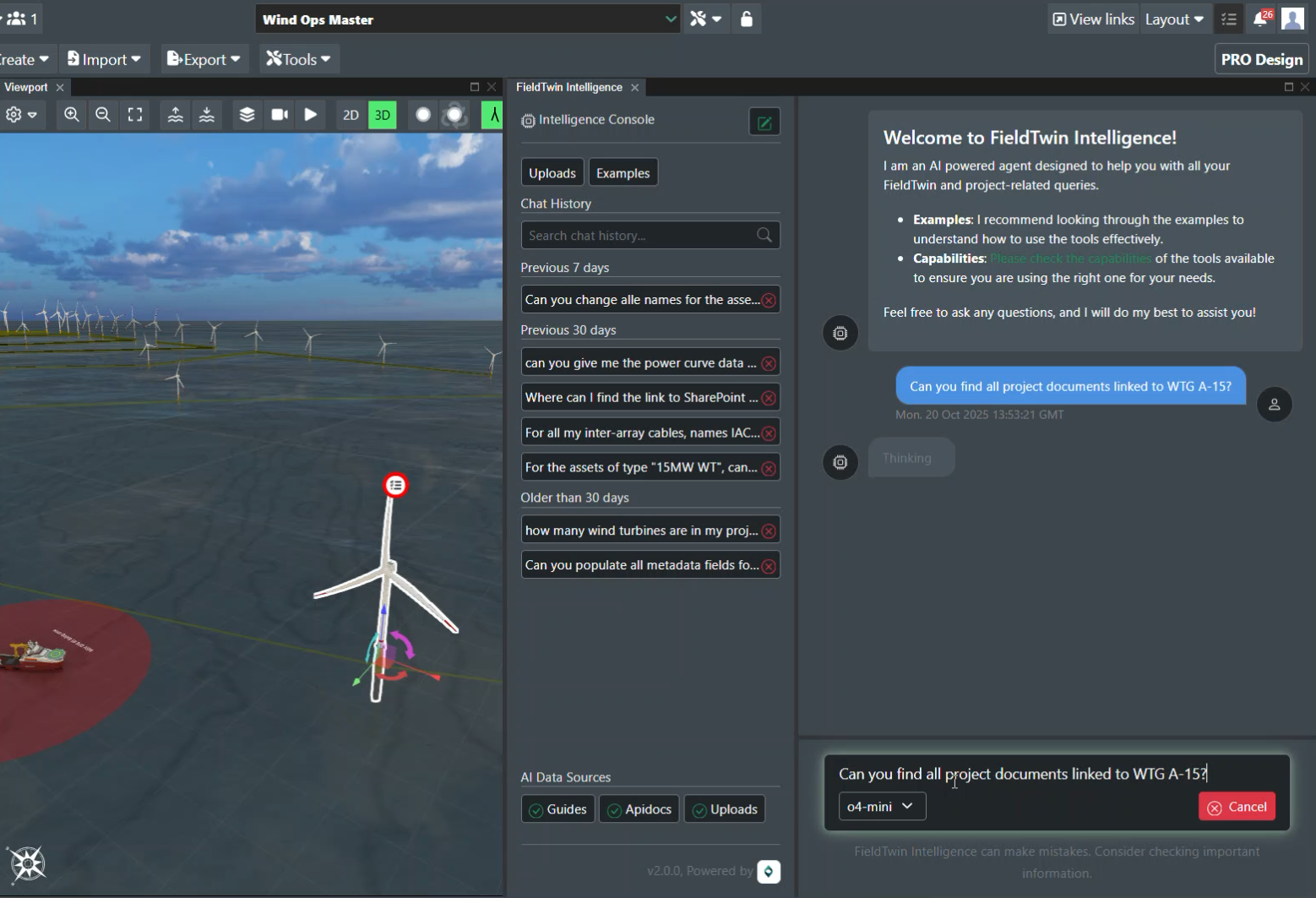
- Give survey, geo and engineering team - plus OEMs and EPCIs - controlled access to the same model.
- Annotate findings, attach key documents, maps and reports, and assign actions with versioned updates.
- All stakeholders review changes in context, avoiding file swaps and ensuring a single, auditable source of truth for decisions.
Design and optimise cable routes
- Use live ground data to plan micro-routes, apply constraints and evaluate burial/protection strategies.
- With Connection Designer, tag segments with specs, costs and installation parameters.
- As updated survey results arrive, teams can quickly simulate alternatives and quantify impacts on length, risk, and cost.
Build a digital record of change
- Capture evolving seabed conditions and asset positions from early surveys through to operations.
- Optimize designs and mitigate operational risk by comparing ground data over time - supporting better design confidence, integrity management, and long-term reliability.
Survey data in context
Consolidate all subsurface and survey data into a single visual environment.
Faster response to change
React to new ground models or ROV survey inputs in real time.
Improved collaboration
Enable multi-disciplinary teams and contractors to make shared, data-driven decisions.
Lifecycle visibility
Maintain an evolving subsea record that supports safe, cost-effective operations.
Trusted by teams at leading energy companies


Ready to gain an integrated view of your seabed and subsurface data?
Explore more FieldTwin offshore wind use cases
Rewrite how engineering gets done
Get in touch to discover how FieldTwin can optimize your project performance.