

Connect your portfolio in one visual workspace
From design to decommissioning, bring together your data, tools and teams in a single workspace – with integrated AI that turns information into instant insight.
The challenge isn’t collecting data – it’s connecting it
The challenge
Wind projects depend on dozens of tools and teams.
Data sits in silos – spreadsheets, workflows and systems that don’t talk to each other.
Context gets lost and time gets wasted. Progress slows.
The reality
Even when projects move fast, teams still work in isolation.
Information doesn’t flow between phases or disciplines.
The result: disconnected work, limited visibility, delayed delivery.
The opportunity
What if your existing data, tools and applications could finally work together?
Connected information means faster insight and better decisions.
FieldTwin makes that happen.
Connect data and teams across the entire project lifecycle
DECOM
Safe, visible decommissioning can make or break a developer’s reputation.
- Reduce costs and compliance risks with complete project and asset history across an integrated 4D data model
- Retain decision rationales and continually review removal or repowering strategies against up-to-date asset data, using integrated scenario analysis tools
- Provide transparency for regulators and stakeholders to support safety, compliance and sustainability
APPRAISE
Your trusted systems, interfaced through one connected platform.
- Integrated concept development with your existing SaaS tools and datasets across wind resource, subsea, grid and cost
- Design, collaborate and compare with real-world geospatial context
- Connect workflows and data through FieldTwin’s open API for automated data exchange and change management
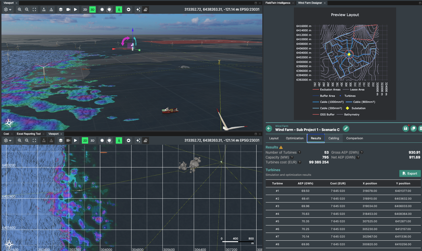
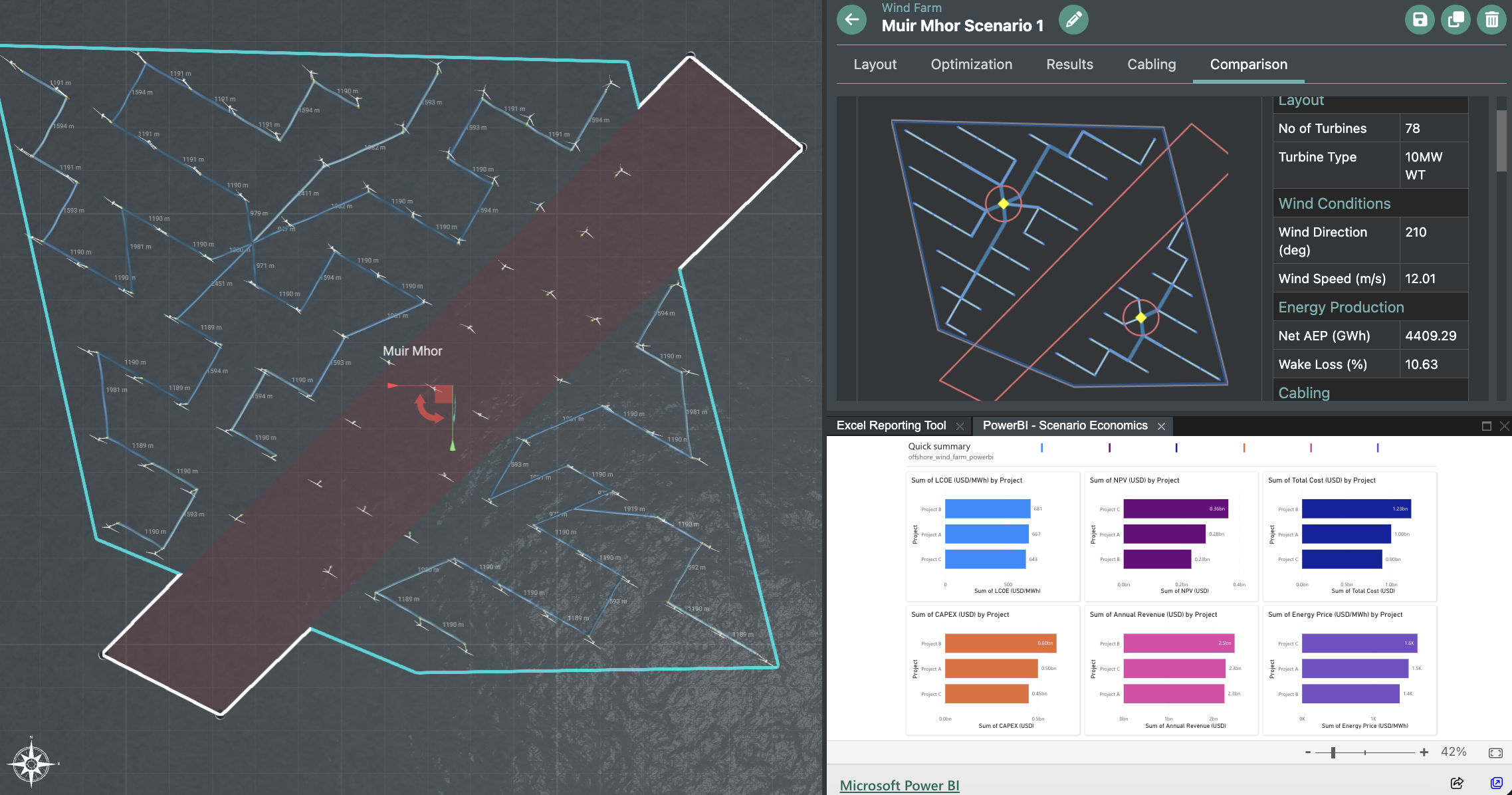
SELECT
Maintain your data foundation and domain context as a digital thread to transform project decisions and change management.
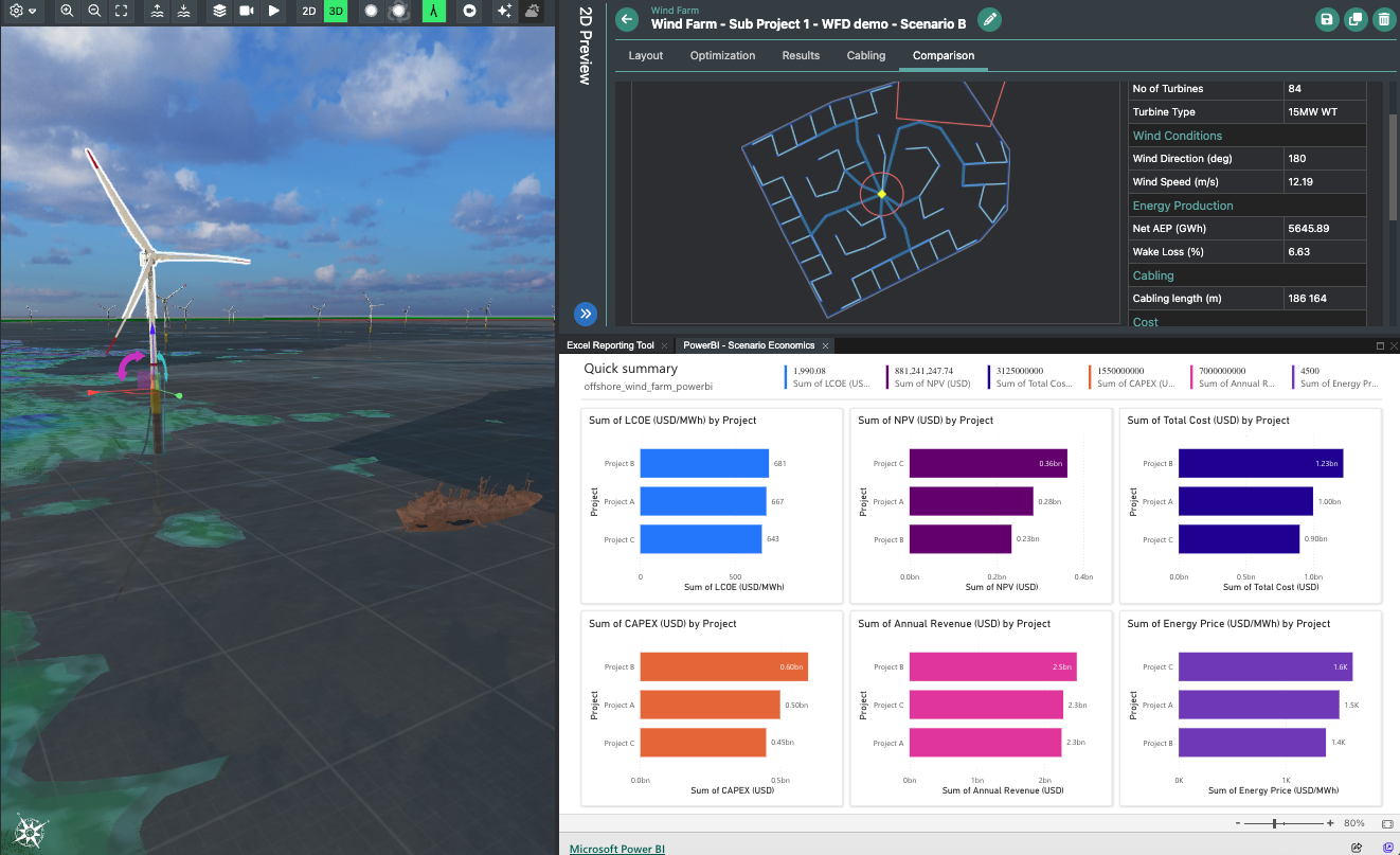
- Liberate your scenarios from siloed applications and black box analysis
- Integrate concepts with trusted validation workflows and IP across wind resource, engineering, planning and economics
- Bring context to interdependent workflows and put systems thinking at the heart of design optimisation
- Iterate in real time, without duplicating work
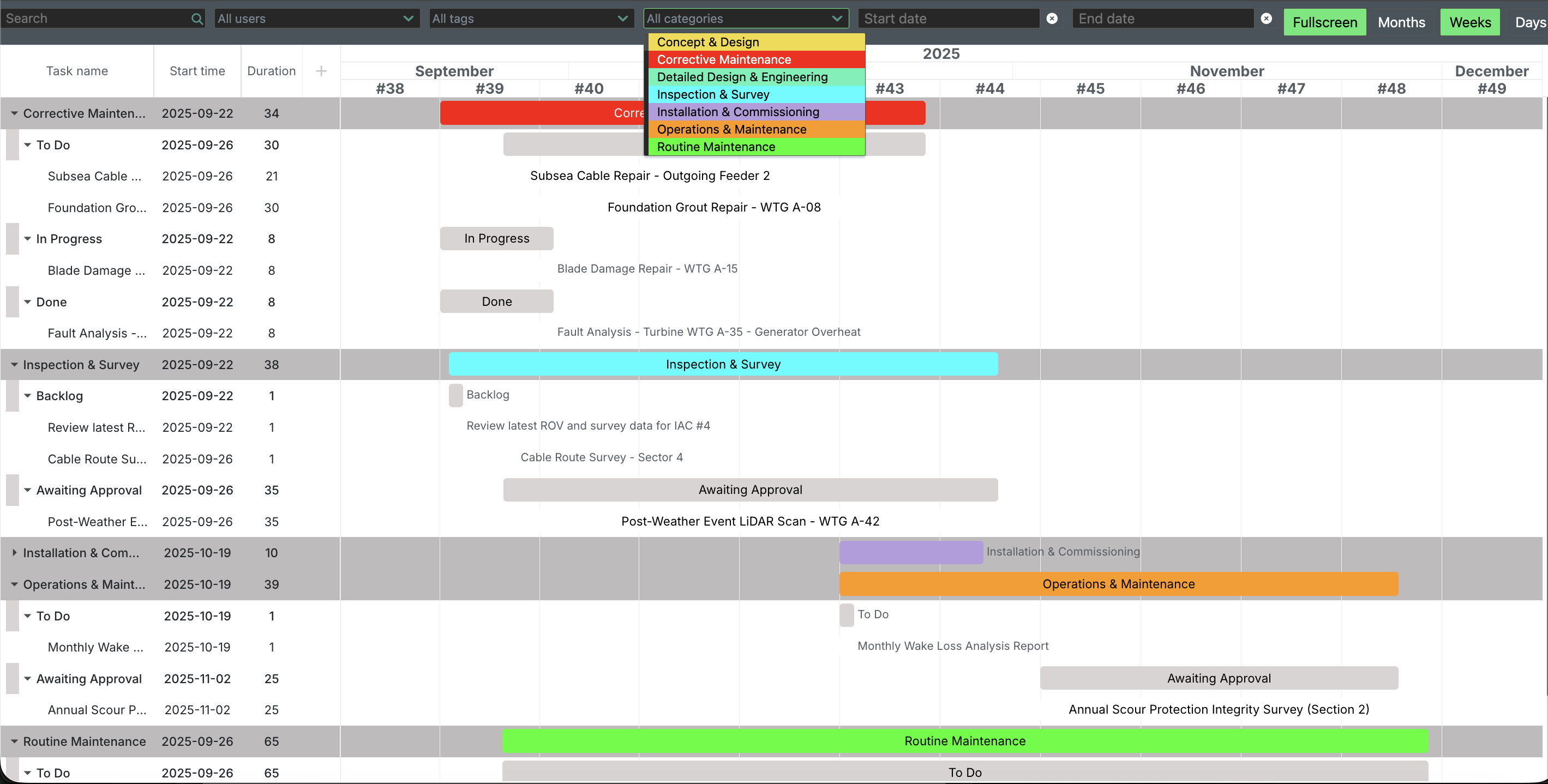
PROJECT EXECUTION
Coordinate complex operations and multiple suppliers.
- OEMs, foundation installers, cable-lay contractors and heavy-lift vessel operators can collaborate seamlessly
- Manage interfaces with precision in geospatial 3D, secure data access and in-platform communication
- Integrated GIS and 3D visualization prevent spatial conflicts, reduce marine operations clashes, and avoid costly delays
OPERATE
Connect your entire offshore wind asset ecosystem
- Connect O&M workflows quickly around a live geospatial model with built-in communication and workflow tools
- Interface with web-based systems easily, and build deeper integrations as you need them through the API, solution developer kit and platform support
- Create a "twin of twins” - linking assets, OEMs and service providers with data and solutions in full context
Integrate your workflows and collaborate across portfolios, from development to decommissioning
-
Unlock value from your digital investments
FieldTwin interfaces with the tools and software you already use — and the people who use them.
- Connect data, insights and analysis...
- All disciplines and stakeholders work from the same context
- Reduce switching, rework and duplication
-
Unblock workflows
Eliminate manual data tasks and create automated, connected workflows across project teams.
- Integrations with your existing systems make the right data instantly accessible
- Model for uncertainty quickly across trusted data from interdependent disciplines
- Enable faster decisions and better change management.
When project needs evolve, FieldTwin keeps pace - replacing awkward file exchanges between GIS, Excel and blackbox SaaS tools with seamless, automated data flow.
-
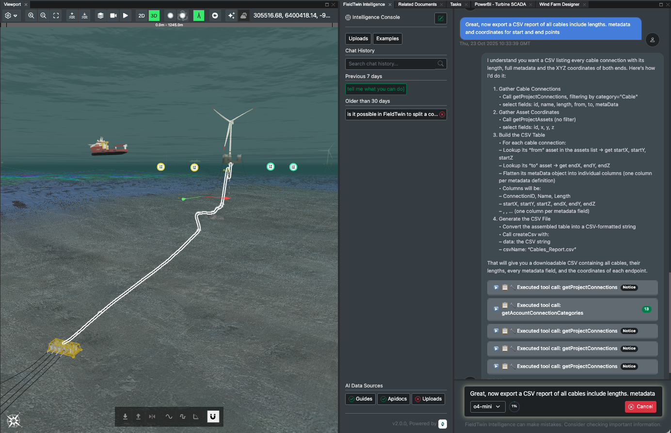
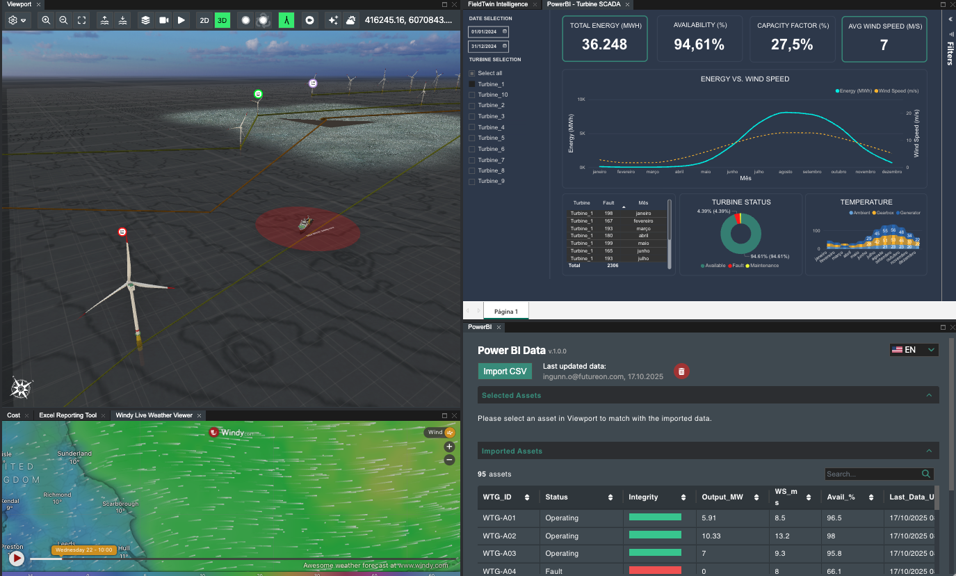
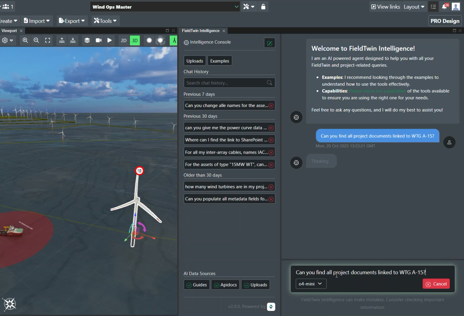
Find project data – fast
Fieldtwin offers versatile solutions to access and query your data.
- Link your document management systems to the geospatial network and object model
- Engage with our cutting edge AI co-pilot for query and analysis, powered by leading LLMs.
-
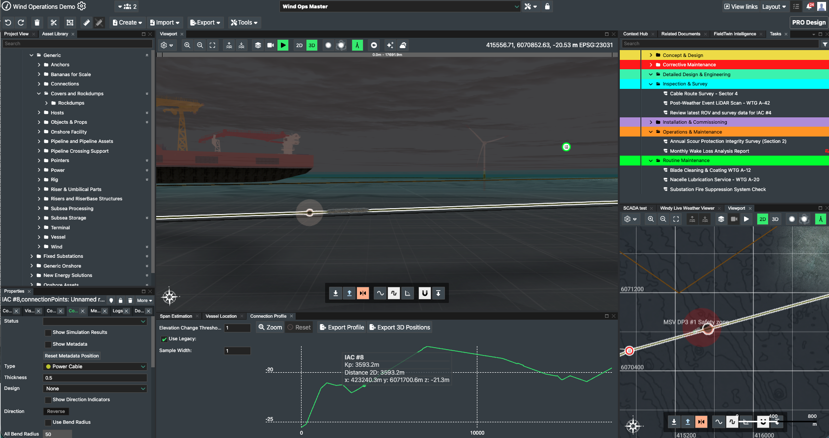
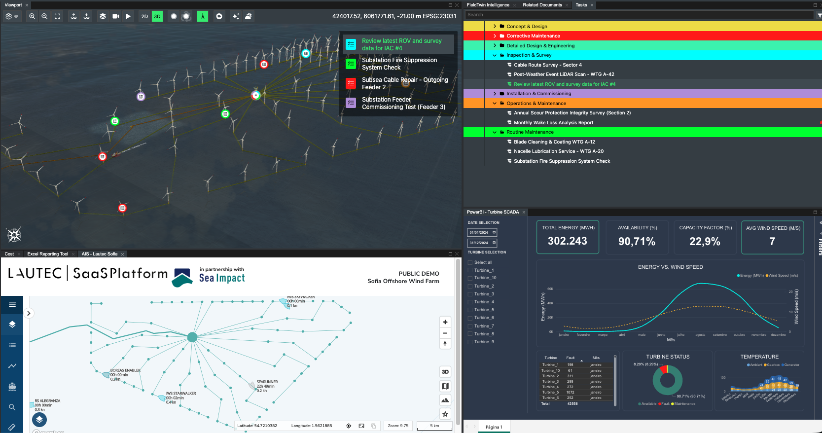
See the full picture
Connect your engineering teams with a integrated and dynamic data model, across all domains.
Surface - Farm layouts as a network topology, Engineering documents and as-built plans, rich 3D asset models with configurable metadata
Subsea - Detailed seabed engineering, Historical ROV, Point clouds and survey data Subsurface - Interpreted ground models, borehole and CPT data.
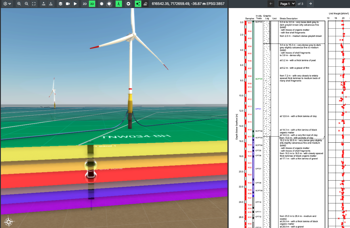
-
Built to scale
Unlike early design tools that stop short at FEED, FieldTwin carries decisions, context, and data forward through construction, operations, and decommissioning.
- Enable seamless digital handovers between teams and project phases
- Bring as-built data to life in operations
- Leverage your operational insights for phased developments and repowering
- Ensure nothing gets lost as your project evolves.
See FieldTwin in action
See value in weeks – build quickly and configure with our flexible support, as you need.
Start small, see value fast
Work with our teams to map your data and business requirements.
We support you to scope and build out a valuable solution in weeks, not months.
A versatile platform with flexible support
Work with the API directly or engage our specialists to configure workflows and integrate your solutions.
You stay in control while we ensure value lands quickly and scales easily.
Strengthen your stack, don’t replace it
FieldTwin ensures every team works from the latest data and deliverables across your existing, specialist workflows.
With built-in AI, you can prototype integrations quickly and unlock value across your workflows.
What used to take six months now takes six weeks.
Director, Field Development Group


Digital transformation tailored to you
Map your platform needs with our team. See FieldTwin's value in real-time.