

Wind Farm Designer
Design Optimal Wind Farms: Wind Farm Designer
Now you can position turbines, simulate energy production, and optimize your design in one integrated environment


Wind Farm Designer
Create and test complete wind farm layouts in minutes instead of weeks
-
What you can do
- Design complete wind farms with customizable turbine spacing and orientation
- Simulate energy yields with realistic wake effects and environmental data
- Optimize turbine placement to maximize Annual Energy Production (AEP)
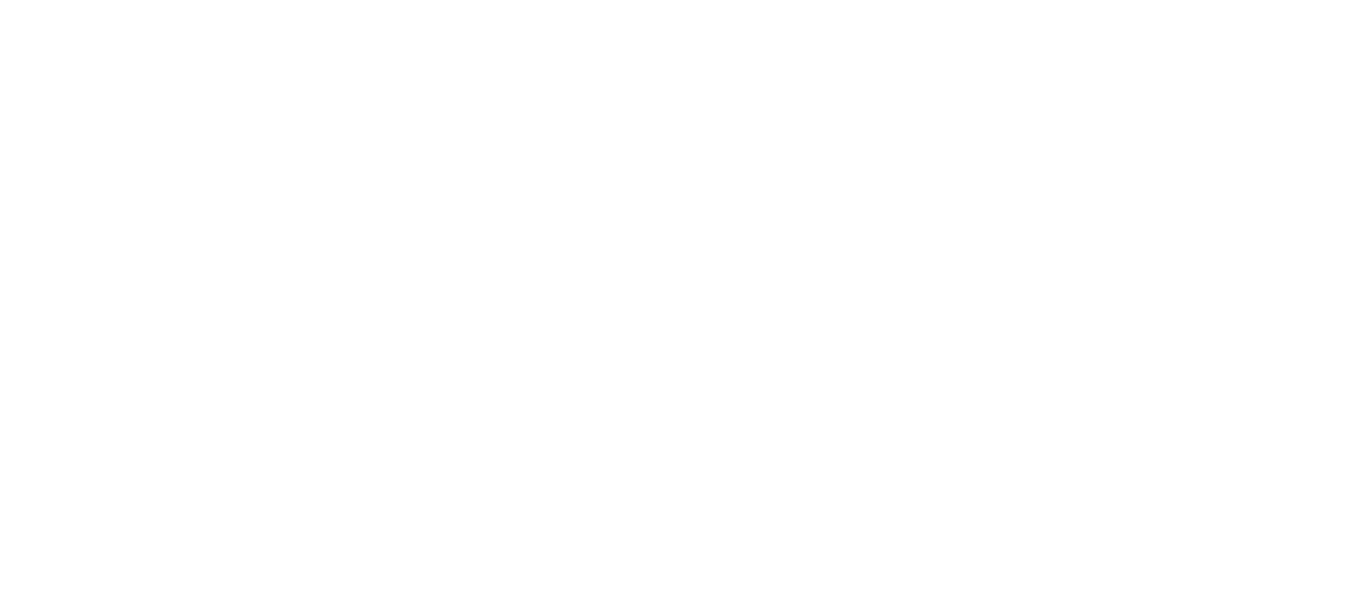
- Plan floating wind infrastructure including mooring lines and shared anchors
- Compare multiple layout scenarios to find the most efficient design
-
How it works
The Wind Farm Designer integrates directly with FieldTwin, providing specialized tools for offshore and floating wind development:
- Comprehensive design tools
- Data-driven simulation and optimization
-
Comprehensive design tools
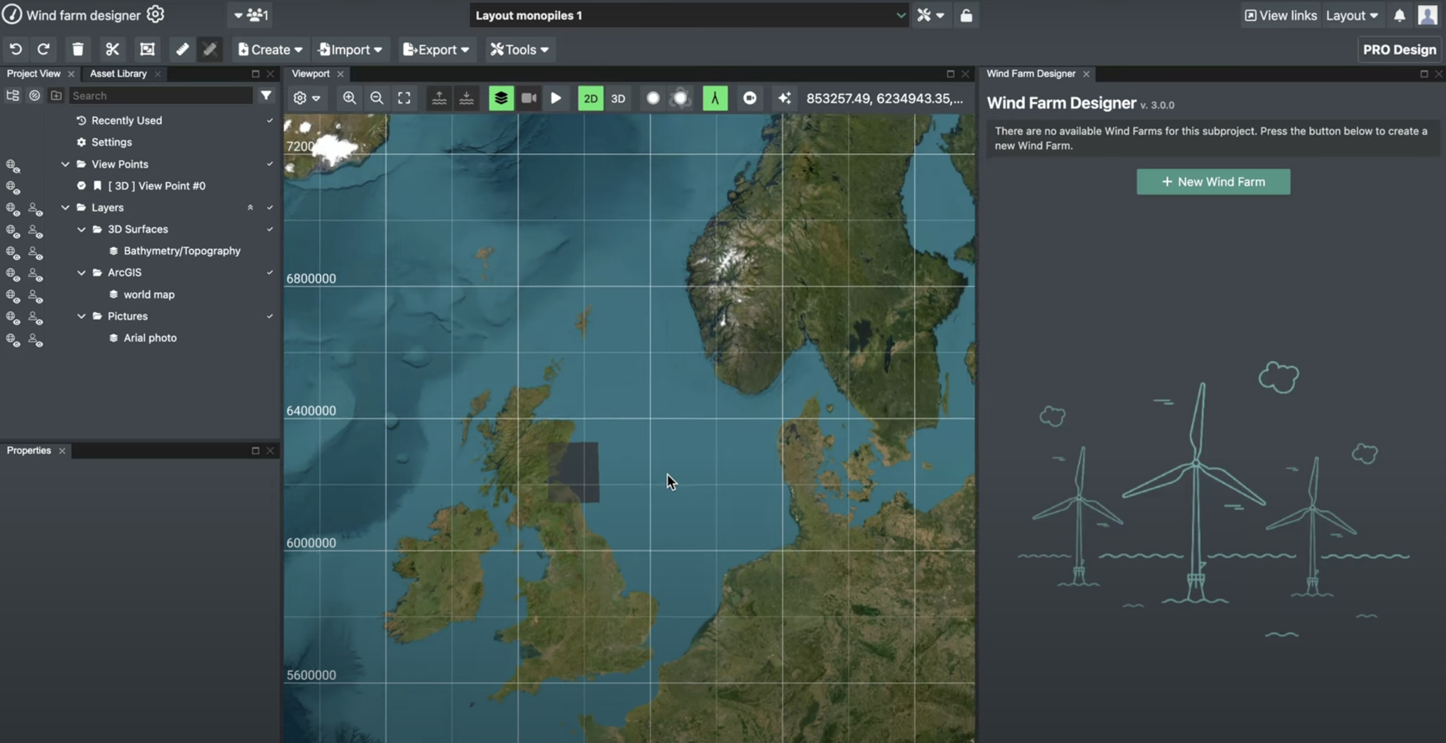
- Define your wind farm area using polygon tools in FieldTwin or import geojson boundary files
- Select from a library of turbine types, foundation types, and anchor configurations
- Configure precise layout parameters:
Minimum turbine spacing (in meters or rotor diameters)
Turbine and foundation orientation
Number of anchors per turbine for floating designs
Minimum anchor radius from turbine position
Snap distance for shared anchor functionality - Choose between rectangular, radial, or triangular grid patterns with adjustable orientation
- Import existing turbine locations from other design tools
-
Data-driven simulation and optimization
- Access Global Wind Atlas data for site-specific wind speed, power density, and frequency
- View wind rose data as reactive metadata at farm scale
- Calculate expected Annual Energy Production (AEP) using PyWake simulation engines
- Visualize wake effects between turbines under various wind conditions
- Generate detailed flow maps showing turbine interactions
- Automatically optimize turbine positions using TopFarm algorithms
- Review turbine-by-turbine AEP results with and without wake losses
- Compare optimized layouts against baseline designs with quantified performance improvements
See the Wind Farm Designer in action

Design, test, and optimize wind farms in one workflow – no more waiting for separate assessments
See performance impacts in real-time without switching tools